You are watching elephants move slowly across an open plain. The horizon feels endless. No fence. No visible border.
Then your guide points gently toward a distant line of hills and explains that beyond that ridge lies community land. In another direction, a conservation area begins. Behind you, national park regulations determine where vehicles can and cannot go.
You cannot see the boundaries, but they are shaping everything.
On safari, the lines you cannot see often shape the moments you remember most.
A Tanzania Wildlife Safari is not defined only by animals and scenery. It is shaped by protected areas, conservation zones, buffer regions, community lands, and migration corridors. These boundaries influence wildlife safety, safari routes, crowd levels, habitat protection, and even the quality of sighting. They are not just administrative lines on a map; they quietly structure the entire experience.
What Park Boundaries Really Mean on Safari
They do more than mark a park entrance. They define how nature is protected and experienced.
When travellers enter places like Serengeti National Park, they cross an official park boundary. But within and around that space, there are different land-use categories.
National parks prioritise strict protection and regulated tourism. Conservation areas such as the Ngorongoro Conservation Area often balance wildlife protection with human settlement or pastoral use. Private concession may limit visitor numbers for lower-density experiences. Buffer zones create transitional space between wildlife habitat and farming communities.
These Tanzania Safari protected areas influence where lodges can be built, where vehicles can drive, how long they can remain in certain areas, and what activities are allowed.
Visitors may not notice these invisible lines, but guides and planners work with Tanzania’s national park boundaries every day.
How Boundaries Protect Wildlife Movement and Habitat
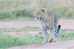
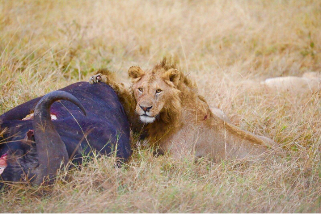
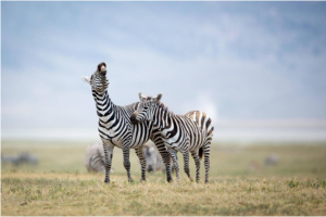
Wildlife does not travel with maps, but survival often depends on protected space. Elephants move seasonally between feeding grounds and water. Wildebeest and zebras follow a grazing pattern. Lions expand their territory when prey shift.
Healthy Wildlife movement in Tanzania parks depends on large, connected landscapes. Park boundaries help reduce habitat loss from settlement, agriculture, and infrastructure development.
Migration corridors linking protected regions are especially important. Without adjoining protected land, movement becomes restricted, and ecological balance is weakened.
A successful Tanzania Wildlife Safari depend on this space remaining intact, not just for famous animals, but for breeding grounds, grazing cycles, and water access that sustain the entire ecosystem.
The Visitor Experience: Why Boundaries Affect Routes and Sightings
The safari route you follow is shaped by rules designed to protect both wildlife and the experience.
Every Tanzania safari route reflects boundary planning. Park limit influence:
Some areas feel busy because they are easy to reach. Others feel quiet because access is tightly controlled.
These differences directly shape the overall Tanzania Safari Experience, from crowd density at sighting to the rhythm of your game drive.
Good management prevents pressure from concentrating in fragile zones.
Boundaries, Communities, and Tanzania Cultural Tourism
The edge of a park is often where wildlife space and human life meet. Near many Tanzania safari conservation areas, communities live alongside protected land. Their livelihoods, livestock, and traditions exist near wildlife corridors.
Responsible Tanzania Cultural Tourism help travelers understand this shared landscape. Tourism revenue often supports schools, employment, guide training, and conservation initiatives that reduce human-wildlife conflict.
When communities benefit from tourism, conservation efforts strengthen. Boundaries become zones of cooperation, not separation.
Why Good Safari Planning Respects Protected Areas
A better safari often comes from understanding where not to go, not just where to go. Experienced Tanzania Travel Guides plan around boundary rules, seasonal road conditions, and wildlife behaviour. They adjust the route to avoid overcrowded zones and protect sensitive areas.
Good planning reduces rushed drives and improves sighting quality. It also ensures compliance with Tanzania Travel Safety guidelines and park regulations.
Thoughtful preparation, reviewing your Tanzania Safari Packing List, understanding Tanzania Safari Cost, securing Tanzania Travel Insurance, and checking the Best Time to Visit Tanzania help align expectations with how protected areas function throughout the year.
Understanding Tanzania Weather further shapes route planning and seasonal wildlife access.
Boundaries and the Future of Tanzania Wildlife Safaris
The future of safari depends on protecting the spaces between famous sightings.
As tourism grows and land use changes, strong boundary management becomes even more important. Climate shift influences grazing zones and water sources. Expanding infrastructure increases pressure on wildlife corridors.
Protecting not only core parks but also surrounding ecological systems will determine the long-term success of every Tanzania Wildlife Safari.
Boundaries safeguard breeding grounds, reduce habitat fragmentation, and maintain sustainable tourism models across key Tanzania Destinations.
CONCLUSION
Park boundaries may be invisible to the eye, but they shape almost every part of a Tanzania Wildlife Safari.
They guide wildlife movement.
They protect habitats.
They influence the safari route and crowd levels.
They connect conservation with community.
Understanding the structure of protected space allows travellers to appreciate safari on a deep level, not just as a wildlife encounter, but as a carefully balanced system that keeps Tanzania’s wild landscapes thriving.